Our Services
NauResa is a leading provider of comprehensive services encompassing surveying, geographic information systems (GIS), information technology (IT), software development, remote sensing, and data entry. With a commitment to excellence and innovation, we deliver tailored solutions designed to meet the diverse needs of our clients across various industries.
Why Choose NauResa?
At NauResa, we combine technical expertise with a client-centric approach to deliver superior services that meet the highest standards of quality and reliability. Our commitment to innovation and continuous improvement ensures that we stay ahead in an ever-evolving industry landscape.
Surveying and Mapping
At NauResa, we specialize in a wide range of surveying services, employing cutting-edge technology and expertise to deliver precise and reliable data for various applications. Our comprehensive surveying capabilities include:
1. Land Surveys:
Determining cadastral boundaries of a parcel of land, essential for property transactions and land development projects. Mapping the natural and man-made features of a site, including elevation changes, vegetation, structures, and utilities.
2. Construction Layout:
Establishing precise locations and dimensions of proposed structures, roads, utilities, and other features. Verifying that constructed elements are in accordance with design specifications and regulatory requirements.
3. Utility Surveys:
Identifying and mapping underground utilities such as water, sewer, gas, electric, and telecommunication lines. Determining the boundaries and easements of utility corridors, ensuring proper maintenance and management of infrastructure.
4. Geodetic Control Surveys:
Using Global Positioning System (GPS) or Global Navigation Satellite System (GNSS) technology to establish precise horizontal and vertical control points. These surveys provide accurate geospatial data for large-scale mapping, infrastructure development, and scientific research.


GIS and Spatial Analysis
At NauResa, we specialize in harnessing the power of geographic information systems (GIS) to provide comprehensive spatial solutions tailored to the needs of our clients across various sectors. With a deep commitment to innovation and accuracy, we leverage cutting-edge technology and robust data analytics to deliver actionable insights and drive informed decision-making.
Mapping and Spatial Analysis:
We excel in creating accurate and visually compelling digital maps that serve as powerful decision support tools. Our spatial analysis capabilities encompass overlay analysis, terrain modeling, and hotspot identification, enabling clients to extract meaningful patterns from geographic data.
Geodatabase Design and Management:
We design robust geodatabases tailored to organize and integrate spatial datasets efficiently. Our expertise in database management ensures data integrity, accessibility, and scalability, supporting seamless information retrieval and analysis.
Custom GIS Application Development:
Tailored to meet specific organizational needs, our custom GIS applications empower clients with intuitive interfaces for data visualization, analysis, and decision support. Whether web-based or mobile, our solutions enhance operational workflows and productivity.
Geospatial Consulting and Training:
Our experienced consultants provide strategic GIS advisory services, guiding clients in GIS implementation, workflow optimization, and spatial data strategy development. We also offer comprehensive training programs to empower users with practical GIS skills and best practices.
Environmental and Urban Planning Services:
Supporting sustainable development goals, we assist in environmental impact assessments (EIAs), urban planning, and natural resource management. Our spatial analyses inform land use planning, biodiversity conservation, and climate change adaptation strategies.
Infrastructure and Utility Management:
We specialize in mapping and managing utility infrastructure, optimizing asset management, and enhancing service delivery efficiency. Our GIS solutions facilitate spatial asset tracking, predictive maintenance, and infrastructure optimization.
Excise and Taxation:
Our experts plays a crucial role in taxation by providing spatial intelligence and analytical capabilities that enhance tax assessment, collection, and management processes.
- Property Assessment and Valuation
- Parcel Mapping and Identification
- Exemptions and Deductions Management
- Spatial Data Visualization and Reporting
- Support for Tax Policy and Decision-Making
Remote Sensing and Image Analysis
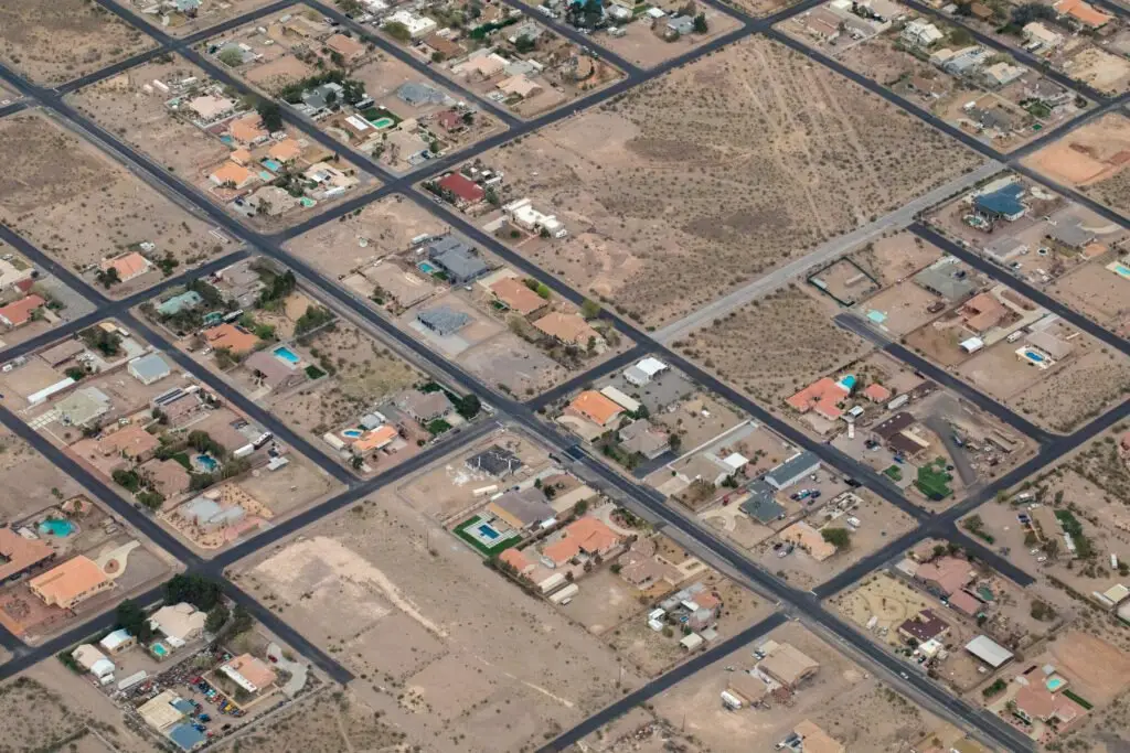
Using advanced remote sensing technologies, NauResa gathers valuable data from aerial and satellite imagery. Our capabilities in image analysis and interpretation support applications in environmental monitoring, agriculture, disaster management, and urban planning.
Remote Sensing Services:
Utilizing state-of-the-art satellite and aerial sensors, we capture high-resolution imagery to monitor environmental changes, assess land cover dynamics, and support natural resource management.
Image Processing and Analysis:
Our skilled analysts employ sophisticated algorithms and machine learning techniques to process and analyze vast volumes of imagery data. This includes feature extraction, classification, and change detection for accurate decision-making.
Geospatial Intelligence:
We provide geospatial intelligence solutions tailored to meet specific client needs, delivering insights into urban growth patterns, agricultural productivity, infrastructure development, and disaster response planning.
Customized Solutions:
At VistaSense, we understand that each project is unique. We offer customized remote sensing solutions and tailored analytical workflows to address specific challenges in sectors such as agriculture, forestry, environmental monitoring, and urban planning.
Consulting and Advisory Services:
Our team of remote sensing experts provides strategic consulting and advisory services, guiding clients in leveraging spatial data for informed decision-making. We assist in project planning, data acquisition strategies, and result interpretation.
Innovative Technology Integration:
We continually innovate by integrating cutting-edge technologies into our remote sensing operations. This includes automated image processing pipelines, cloud-based data storage solutions, and interactive visualization platforms for enhanced client collaboration.


IT Solutions and Software Development
Our IT services encompass a wide range of solutions tailored to enhance organizational efficiency and security. NauResa develops customized software solutions to meet specific business needs. Whether it’s web applications, mobile apps, or enterprise software, our development team delivers scalable and innovative solutions that streamline processes and drive business growth.
Custom Software Development:
Designing and developing bespoke software solutions tailored to meet unique business requirements using various programming languages and frameworks including Python, Java, .NET, and JavaScript.
Enterprise Application Development:
Building robust and scalable enterprise applications to streamline business operations. Ensuring seamless integration with existing systems and platforms.
Data Analytics and Business Intelligence:
Transforming data into actionable insights with advanced analytics and business intelligence solutions. Enabling businesses to make informed decisions through real-time data analysis.
IT Consulting and Strategy:
Offering expert IT consulting services to align technology strategies with business objectives. Providing strategic insights to drive operational efficiency and innovation.
IT Support and Managed Services:
Delivering comprehensive IT support and managed services to ensure seamless IT operations. Services include network management, system monitoring, helpdesk support, and maintenance.
Data Entry and Management
NauResa provides accurate and efficient data entry services to digitize and organize information. Whether handling large volumes of data or specialized data entry requirements, our dedicated team ensures meticulous attention to detail and timely delivery.
Data Entry Services:
Offering comprehensive data entry solutions for both manual and automated data capture. Services include data input from various sources such as paper documents, forms, photos, and digital files. NauResa Ensures high accuracy and fast turnaround times with rigorous quality control processes.
Data Management:
Providing end-to-end data management services to organize, store, and maintain data. Services include data cleansing, data normalization, and data enrichment. Implementing effective data governance practices to ensure data consistency and reliability.
Database Management:
Designing, implementing, and managing robust database solutions tailored to business needs. Services include database creation, migration, optimization, and maintenance. Ensuring data integrity, security, and performance with state-of-the-art database technologies.
Document Digitization:
Converting physical documents into digital formats for easy access and management. Services include scanning, indexing, and archiving of documents. Utilizing advanced OCR (Optical Character Recognition) technology for accurate data extraction.
Data Processing:
Transforming raw data into usable formats through comprehensive data processing services. Services include data conversion, data validation, and data analysis. Providing customized data processing solutions to meet specific business requirements.
Data Analytics:
Leveraging advanced analytics tools to turn data into actionable insights. Services include descriptive, predictive, and prescriptive analytics. Helping businesses make data-driven decisions to enhance operational efficiency and growth.
IT Support for Data Management:
Offering IT support services to ensure smooth data operations. Services include system setup, troubleshooting, and technical support. Providing 24/7 support to minimize downtime and ensure business continuity.

